Up Willow Valley Road
Up Boulder Street
Up Red Dog Road
Down Rocker Road
Up Banner Mountain Trail
Up Bandolier Way
Out Snow Mountain Ditch
Up Red Dog Road
Down Banner Lava Cap Road
Down Idaho Maryland Road
Down Lee Lane
Down Blackberry Place
Down Loma Rica Drive
Along Ditch
Down East Bennett Road
Down Whispering Pines Lane
Down Idaho Maryland Road 17.33 Miles
1924 Feet Climbing
1:40 Hours
1413 Calories
124 Average HR
167 Max HR
63 Cadence Average
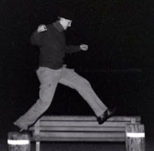
On the cyclocross bike. Did 2 sets of moderate 17 minute intervals. Found some jumps and a ladder bridge down by Willow Valley Road on Boulder Street.
12/8/08
Moderate Intervals - 1 3/4 Hours - Banner Mountain Area
12/6/08
Basic I - 6 hours - South Yuba

 Up Cement Hill
Across Wet Hill Ditch
Across Airport Ditch
Down Lake Vera Purdon Road
Up Round Mountain Flume Trail
Down Round Mountain Switchbacks
Up South Yuba Trail
Up North Bloomfield Road
Down North Bloomfield Graniteville Road
Up and down Rim Trail
Down the Vonnegut trail
Down Graniteville Road
Down Missouri Bar Trail
Down South Yuba Trail
Down North Bloomfield Road
Up North Bloomfield Road 40.99 Miles
6806 Feet Climbing
5:55 Hours
4606 Calories
141 Average HR
177 Max HR
On the Giant Trance X1. Long ride. Rode consistent, but not very hard. Was cool and dry, great weather on a clear fall day. Long solo ride. These Kenda tire sidewalls suck!
 NID modified a section of the Across Wet Hill Ditch.
 The Airport Ditch on a fall day.
 A trail over in the Round Mountain area.
 The South Yuba canyon with the Sutter Buttes in the background.
 The South Yuba trail headed upstream from the Round Mountain Trail.
 The bridge at Edwards Crossing with frost on it.
 Taking a break and taking layers off for the climb up to Malakoff Diggins.
 The top of the climb at Lake City with the Grouse Ridge area in the far distance.
 The South Yuba Trail below the Missouri Bar Trail.
 A mining claim on the South Yuba River.
 The South Yuba Trail winds through a flood plain.
 Look upstream on the South Yuba Trail.
 A fun little section of the South Yuba Trail. The river is about 100 feet down on the left.
 The South Yuba River.
 These Kenda tires have the thinnest, weakest, most piece of crap sidewalls. A little scratch on the sidwall and I have a flat. Ghetto Tubeless setup shown. I don't like and it and won't be doing it again. These tires suck.
12/3/08
Basic I - 2 Hours - Bitney Springs Area

 Up East Main Street
Up Hughes Road
Down Ridge Road
Down Rough & Ready Highway
Down Bitney Springs Road
Up Bar Ranch Road
Up Bitney Springs Road
Down Rudd Road
Up Rudd Road
Up Bitney Springs Road
Up Rough & Ready Highway
Up Ridge Road
Up & Down Dorsey Drive
Down East Main Street 24.09 Miles
2515 Feet Climbing
2:06 Hours
1402 Calories
119 Average HR
154 Max HR
On the CX bike. Training ride down to two job sites. Found some nice trails alongside Ridge Road & Rough & Ready Highway.
12/2/08
Basic I - 2 1/4 Hours - Scott's Drop

 Up Uren Street
Up Snow Mountain Ditch
Up Willow Valley Road
Up Lone Grave
Down Scott's Drop
Along Scott's Flat Lake trail
Up Scotts Flat Road
Down Scotts Valley Road
Down Willow Valley Road
12.21 Miles
2409 Feet Climbing
2:08 Hours
1741 Calories
On the singlespeed. Didn't have HR monitor on. Supergirl's light died early so we came down the road instead of trail. Accompanied by Raphael & Supergirl.
Subscribe to:
Posts (Atom)